February 6, 2023
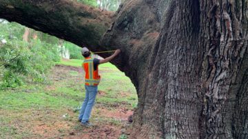
Scanning Branches
Along with roots and trunks, our Ground Penetrating Radar has the capacity to do aerial scanning on the trees’ limbs....
Read Post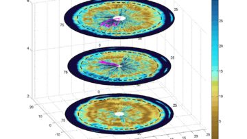
February 3, 2023
Trunk Scans
Ground penetrating radar (GPR) uses wave technology to non-invasively provide an image (radargram) of the internal structure...
Read Post
February 3, 2023
Excessive Moisture and Root Loss
One of the biggest factors that can cause stress in trees is water. Along the soil moisture spectrum, flooding and drought...
Read Post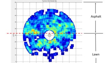
February 1, 2023
Soil Compaction: The Root Killer
With our patented soil aeriation technology, our company is acutely aware of the dangers of soil compaction to roots....
Read Post